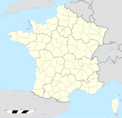
Lièpvre
Lièpvre (elsässisch Laweröi, daitsch Leberau) isch e franzesische Gemää im Département Haut-Rhin (Owwaelsass) in de Rechion Grand Est (bis 2015 Elsass).
| Lièpvre | |
|---|---|
|
| |
 | |
 | |
| Verwaltung | |
| Land |
|
| Region |
|
| Département | Haut-Rhin (68) |
| Arrondissement | Colmar-Ribeauvillé |
| Kanton | Sainte-Marie-aux-Mines |
| Kommunalverband | Val d'Argent |
| Amtlicha Name | Lièpvre |
| Maire | Pierrot Hestin (2014-2020)[1] |
| Code Insee |
68185 |
| Boschtlaitzahl |
68660 |
| Aiwohner | |
| Aiwohner | 1.653 |
| Flech | 12,55 km2 |
| Bevelkerungsdicht | 138,73 Iiw./km2 |
| Lach | |
| Koordinate | 48° 16′ 20″ N, 7° 16′ 57″ E / 48.272222222222°N,7.2825°EKoordinate: 48° 16′ 20″ N, 7° 16′ 57″ E / 48.272222222222°N,7.2825°E |
| Hech | 270 m |
| Website | |
| http://www.liepvre.fr | |
D Gemää gheat zum Kanton Sainte-Marie-aux-Mines im Arrondissement Colmar-Ribeauvillé.
Geografie
SchaffeLièpvre licht 58 km vun Mìlhüüse uf 473 m NN.
Gschicht
SchaffeLièpvre isch im Johr 763 zum easchte Mol gnennt worre.
Verwaltung
SchaffeDe Maire vun Lièpvre isch de Pierrot Hestin. Lièpvre gheat zum Kommunalvaband Val d'Argent.
Bevelkerungsentwicklung
Schaffe| Johr | 1968 | 1975 | 1982 | 1990 | 1999 | 2008 |
| Aiwohner | 1639 | 1520 | 1536 | 1558 | 1633 | 1747 |
Dialekt
SchaffeDe romanisch Dialekt vun Lièpvre gheat zum Welche un domit zum Lorrain.
Weblinks
SchaffeFußnote
Schaffe- ↑ (franzesisch) Liste des maires au 25 avril 2014 (data.gouv.fr)
Altwihr | Ammerschwihr | Bànnwihr | Barge | Bawle | Dànnekìrich | Fréland | Geemàr | Hunewihr | Ìllhisre | Kaysersberg Vignoble | Kàtzedàl | Labaroche | Lapoutroie | Le Bonhomme | Lièpvre | Màrkirich | Mìttelwihr | Orbey | Ostheim | Ràppschwihr | Richewihr | Rodere | Rombach-le-Franc | Rorschwihr | Sainte-Croix-aux-Mines | Sàmpìlt | Zallebarg
